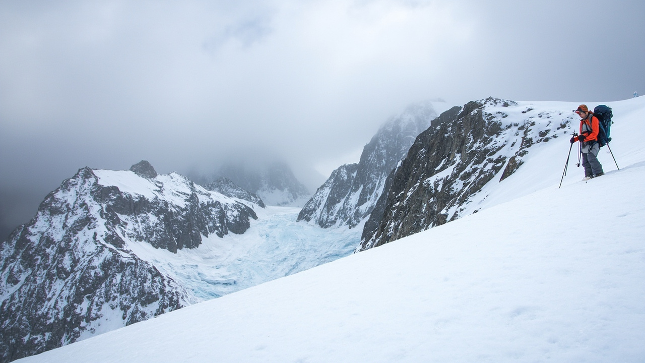
TL;DR: Avalanche Canada and Parks Canada posted early-season alpine bulletins on Oct. 1-3, 2026 warning that thin fall snow can already slide on smooth high slopes, so carry transceiver, probe and shovel and make your own avalanche assessment until daily forecasts start in November.
Early-October answer for high-country travelers
Avalanche season has returned to the alpine of western Canada even though valley trails remain snow-free. According to the Glacier (Canada) Avalanche Forecast — Danger Level Today, snow had started to accumulate at upper elevations with the transition to fall, and small avalanches had occurred on smooth alpine slopes during recent snowfalls. According to Boletín de aludes de Jasper — Oct 2, 2026 - avalog, avalanche season is upon us in the alpine in Jasper, with danger highest after new snowfall, rain, or wind transport. According to the Banff-East Side 93N-Field-Kootenay-Lake Louise-Little Yoho (Canada) Avalanche Forecast — Danger Level Today, fall brought cooler temperatures and snow in the high alpine, with deeper accumulations in alpine lee and gully features. The practical meaning for survival readiness is direct: if travel involves high bowls, gullies, ridgelines, or glaciers in early October, treat the trip as avalanche terrain and winter glacier travel.
The timing matters because regular winter products were not yet running. The Glacier bulletin published on Oct. 3, 2026 at 11:00 p.m. was valid until Thursday, Oct. 15, 2026 and listed Maximum Danger 1 · LOW for alpine, treeline, and below treeline. The French Avalanche Canada page for the same period showed it was published Sat. Oct. 3, 2026 at 16:00 PT, valid until Thu. Oct. 15, 2026 at 16:00 PT, and prepared by Parks Canada. That page listed large zones of Glacier National Park as CLOSED for preventive avalanche control using EXPLOSIVES, with links for real-time zone status and winter access permit system information. The Banff-East Side bulletin published Oct. 1, 2026 at 11:00 p.m. was also valid until Oct. 15, 2026 and listed Maximum Danger 1 · LOW across all three elevation bands. The Jasper bulletin published Oct. 2, 2026 was listed as valid until Nov. 30, 2026 and rated by Avalanche Canada, with alpine and treeline shown as early-season and below treeline shown without rating. Daily avalanche hazard forecasts begin in November, as stated in the Glacier bulletin, while the Banff-East Side bulletin stated regular forecasting will begin November 1st.
What the Oct. 2-3 bulletins actually said
Parks Canada prepared the Glacier bulletin carried on Avalanche Canada. It advised travelers in the high country to pack a transceiver, probe and shovel and to factor avalanches into the trip. It described snowpack structure with cooler fall temperatures allowing snow to accumulate in the alpine, and urged caution where the ground is smooth under snow and where wind deposits created localized pockets of deep snow. It defined danger level 1 Low as generally favourable conditions where avalanches are possible mainly with high additional load on very steep terrain. It noted Avycast refreshes hourly while the bulletin is republished by Avalanche Canada — Parks Canada usually once a day during the season, and it identified Avalanche Canada — Parks Canada as the official warning service.
The Jasper bulletin carried the same early-season message with more detail on process. Its essentials section said to use Weather Stations, the ACMG Mountain Condition Reports, and the MIN for conditions, or to ask Visitor Safety at 780-852-6155. Its avalanche summary said early-season faceting may have weakened the bond of the thin fall snowpack to steep ice gullies and faces, and urged extra caution in high, icy arenas. It noted Persistent Slabs have surprised parties in recent years, giving late-season Mt. Athabasca climbers as an example. It stated avalanche season is here and directed travelers to do their own avalanche forecasting, to carry a transceiver, shovel and probe, and to know how to use them. Its snowpack summary was labeled an early-season overview and warned alpine areas could gain enough snow for avalanches over the next couple of weeks.
The Banff-East Side bulletin emphasized local variability. It told travelers to pay attention to local snow amounts and to watch for deeper accumulations in alpine lee and gully features. Its snowpack structure description said the early-season snowpack is typically thin and widely variable, presenting deep drifts and areas scoured to the ground. It said localized pockets of wind slab are common, meaning it can be easy to step from dry ground into a wind slab, so watch carefully for these pockets of snow. Its danger by elevation also listed Alpine 1 Low, Treeline 1 Low, and Below treeline 1 Low.
Where thin snow creates disproportionate risk
Thin does not mean safe in early October. The Jasper snowpack summary warned high bowls, gullies, and areas around ridgelines are classic spots for early-season avalanches. It warned vast numbers of open late-summer crevasses are now deceptively hidden by very thin bridges of wind-blown new snow. It said roping up and diligent probing, plus glacier-reading experience, are all critical for safe glacier travel. It added that due to a thin snowpack, glacier travel is also at its trickiest. That combination — enough new snow to bridge a crevasse visually but not enough to support weight, plus enough snow to slide in a gully — defines the early-season trap.
Glacier-area guidance pointed to the same micro-terrain problem. The Glacier bulletin flagged smooth alpine slopes where small avalanches had already occurred during recent snowfalls. Its snowpack summary flagged areas where the ground is smooth under snow and where wind deposits formed localized pockets of deep snow. The Banff-East Side bulletin flagged alpine lee features and gullies for deeper accumulation, plus deep drifts beside ground scoured to bare earth. The Jasper bulletin said danger is highest after new snowfall, rain, or wind transport, and said to watch alpine areas as they gain enough snow for avalanches over the next couple of weeks. For route selection, that means favoring low-angle travel without overhead exposure after fresh loading, avoiding wind-loaded bowls and gullies, and treating smooth rock slabs and ice faces with suspicion when covered by thin new snow.
What to carry and how to check conditions
The required personal equipment was consistent across bulletins. The Glacier bulletin listed transceiver, probe and shovel for high-country travel. The Jasper bulletin listed transceiver, shovel and probe plus knowledge of use. The French Avalanche Canada page for Glacier recommended training from a reputable school, travel with experienced partners, and carriage of a radio-transceiver beacon, probe, shovel, bivouac sack, and emergency communication device, plus an emergency action plan in mind. It also recommended consulting Parks Canada agents for additional information.
Information checks were also consistent. For current weather, the Jasper weather summary directed travelers to telemetry stations on the Avalanche Canada map page and noted Mountain Weather Forecast is available from Avalanche Canada. The French Glacier page directed travelers to telemetry stations by clicking weather-station icons on the Avalanche Canada map page. For forecast weather, it recommended Environment Canada forecasts for Rogers Pass, and for technical forecasts it recommended SpotWx or Windy. The Jasper essentials listed Weather Stations, ACMG Mountain Condition Reports, and the MIN, plus Visitor Safety at 780-852-6155. The Glacier closure notice directed travelers to real-time zone status and winter access permit system information for Glacier National Park. The bulletins stated information is for personal and recreational purposes only and must not be used for operational or commercial purposes in any case.
Roads, parks, and October weather around the mountains
Early-season mountain readiness extends beyond avalanche terrain to access and valley weather. According to When the Sea to Sky turns to winter: what changes on the trails and the 99, winter tire and chain rules have applied on Highway 99 since Oct. 1, with most B.C. routes requiring winter tires or chains from Oct. 1 to April 30 and some lower-elevation routes ending March 31. Its South Coast map discussion placed Highway 99 from Horseshoe Bay through Squamish and Whistler to Pemberton in the Oct. 1 to March 31 group, with rules applying where regulatory signs are posted. That article summarized provincial tire guidance as at least 3.5 mm of tread marked either M+S or with the three-peaked mountain and snowflake symbol, at least two matching winter tires on the primary drive axle even on a 4x4 with four recommended, chains on summer tires not accepted as a legal substitute, and studded tires allowed on B.C. highways only from Oct. 1 to April 30. It said the province states avalanche season starts in November, runs into May, and is busiest from December through March, with highways in avalanche areas closed when hazard is high or crews do control work with explosives.
The same Corridor 99 guide said not to stop in a marked avalanche area until passing the yellow end avalanche area sign, and that planned and unplanned closures both show up on DriveBC. It listed seasonal park changes including Brandywine Falls day-use gate open 8 a.m. to 8 p.m. until Oct. 31 then closed for off-season with walk-in only and trails not maintained in winter, Stawamus Chief Apron lot gate open 7 a.m. to 9 p.m. until Oct. 15 then always open Oct. 16 to March 14 unless snow blocks access, Alice Lake day-use gate running 8 a.m. to 8 p.m. from Sept. 15 until first snowfall usually late December and closed around the clock with snow on the ground, Porteau Cove day use open in winter with limited facilities, and Garibaldi naming Diamond Head as main winter area for skiing, snowboarding and snowshoeing with year-round avalanche and glacier hazards and no snowmobiles allowed. It said the Sea to Sky Trail stays open year-round for snowshoeing and cross-country skiing but only some sections are cleared, with Whistler maintaining roughly 38 km of Valley Trail through winter.
October weather context came from October Outlook: Canada’s fall transformation – what to expect across the country, published Oct. 1, 2026 at 9:30 a.m. by meteorologist Tyler Hamilton. It described October as Canada’s ultimate transition month that can begin with lingering summer warmth and end with snow and hard freezes, with a dramatic drop in normal daytime highs between Oct. 1 and Halloween. It forecast Act 1 as one last taste of late-summer warmth in Ontario and Quebec with mid-20s warmth, Act 2 as a flip during the first few days of October reconfiguring the pattern, and Act 3 as October behaving like October with continued tug-of-war and variability. For West and North it expected temperatures significantly above seasonal, a pause in the Pacific storm pattern with rainy season hitting snooze in southern B.C., an open Prairie harvest window, and above-seasonal lean in Northern Canada. For East it expected sharper cold fronts, frost and freeze surging south, returning moisture with fall-like systems, possible first snowflake sightings in Ontario and Quebec, and weather described as excellent for leaf peeping.
How to use Avalanche Canada until daily forecasts resume
Avalanche Canada describes itself as a non-government, not-for-profit organization dedicated to public avalanche safety, issuing daily avalanche forecasts through winter for much of western Canada’s mountains free on its website and app, plus awareness and training programs, as summarized in the Corridor 99 guide. If a plan involves avalanche terrain, that guide identifies its forecast and training as the starting point. Until daily hazard forecasts begin in November, the early-October bulletins leave the forecasting task to the traveler. That means checking the Avalanche Canada map-page telemetry, the Mountain Weather Forecast from Avalanche Canada, Environment Canada for Rogers Pass, and SpotWx or Windy for technical detail, plus ACMG Mountain Condition Reports and the MIN in Jasper. It means applying the early-season rules stated in the bulletins: expect Low danger does not mean no danger on very steep terrain with high additional load, expect new snow, rain and wind to raise danger quickly, and expect persistent slabs on steep ice gullies and faces where faceting weakened the bond.