TL;DR: A roughly 6-acre wildfire in rural Boulder County triggered same-day evacuation warnings and a preserve closure before crews reached 25% containment on October 6, 2026.
6-Acre Dry Creek Fire Triggers Evacuation Warnings, Preserve Closure
More than 100 firefighters engaged a new vegetation fire in rural Boulder County on Tuesday, October 6, 2026. The incident, identified as the Dry Creek Fire, covered about six acres of rugged U.S. Forest Service ground north of Highway 7. By mid-afternoon, crews had established line around the perimeter and held containment at 25%.
That early containment figure came from the U.S. Forest Service-Arapaho & Roosevelt office, according to Colorado Public Radio. The agency reported 25% containment at 3:30 p.m., with line in place. Acreage and containment were unchanged at the 6:30 p.m. check.
Where The Fire Started
The fire burned in remote Forest Service land north of Colorado Highway 7 and west of Lyons. Tracking site Watch Duty first logged the report at 8:03 a.m., according to OutThereColorado, published by the Denver Gazette. Another early account placed the origin north of Highway 7 near Forest Service Road 920.
Incident managers described two flanks. Hand crews anchored at the head, where no additional spread was reported. The terrain was steep and difficult to access, which limited direct work in places. Favorable humidity and wind helped crews hold progress through the day despite the access problems.
Firefighters staged apparatus along South St. Vrain east of Allenspark. Officials asked motorists on South St. Vrain Drive, or Highway 7, east of Allenspark to proceed cautiously because engines and crews were entering the roadway.
Evacuation Warnings Issued, Then Lifted
The Boulder County Sheriff's Office issued evacuation warnings Tuesday morning for areas between Allenspark and Hall Ranch. The first warning arrived at 9:12 a.m. for Forest Service lands east of Allenspark between South Sheep Mountain and Coffin Top Mountain, according to Boulder Reporting Lab. At 10:18 a.m., the warning zone expanded east to Hall Ranch, just west of Lyons.
Coverage included Pine Valley and Riverside residents, sections along the Dry Creek St. Vrain Trail, and rural roads in the vicinity. The Sheriff's Office later confirmed that all warnings were lifted at 4:37 p.m. Tuesday, allowing people in those zones to resume normal activities.
No evacuation orders were issued during the incident. That distinction mattered for readiness. A warning called on people to prepare for possible departure, assemble needed items, and arrange transportation. People with mobility limitations, those moving large animals, and others needing extra time were urged to leave promptly rather than wait. Residents and visitors could enroll in county emergency messages at BOCOalert.org.
Aircraft, Hose Lines And Personnel
About 100 fire personnel worked the incident Tuesday afternoon. The Sheriff's Office public information officer, Vinnie Montez, reported steady advancement as hose was extended around the edge, according to Colorado Public Radio.
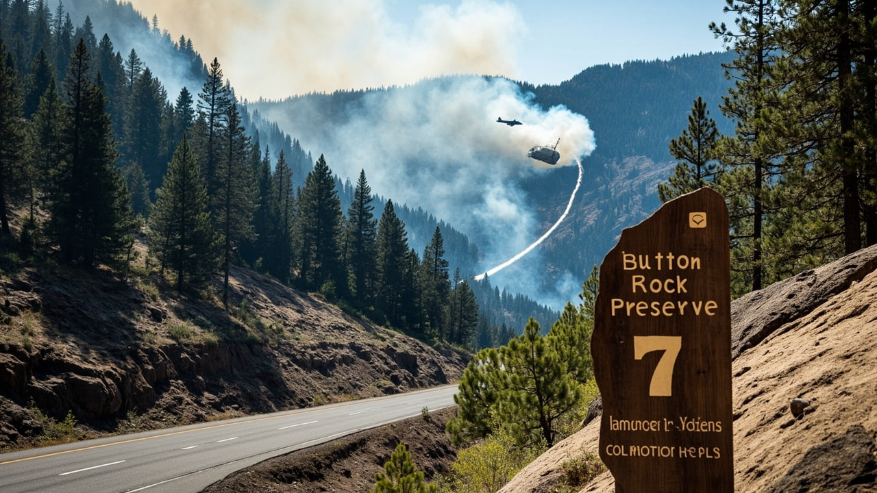
Air resources joined the ground effort. A large air tanker dropped retardant around the perimeter. Flight data cited in local reporting also showed a Type 1 and a Type 2 helicopter on scene, with two single-engine air tankers en route at 10:27 a.m. By about 2 p.m., crews were described as effectively slowing forward progress.
Montez said terrain remained rugged but atmospheric conditions supported operations. In an afternoon update carried by the Denver Gazette, he noted that firefighters continued to make steady progress after the retardant work.
Firefighter Injury And Camp Evacuation
One firefighter sustained a minor injury. Montez said the injury was not serious and the firefighter was able to self-evacuate. A later Sheriff's Office message described the firefighter as in good hands.
Children were moved from the nearby Balarat Outdoor Education camp, operated by Denver Public Schools. The evacuation was precautionary, according to Denverite. The campus itself was not under an order to evacuate or prepare to evacuate.
The Dry Creek Fire burned about five miles north of Balarat, which hosts overnight outdoor programs on a 750-acre campus near Jamestown. A group of fifth graders on an overnight visit was returned home Tuesday instead of remaining at the facility with fire activity nearby. Denver Public Schools spokesperson Scott Pribble said the district acted out of an abundance of caution and would work with Balarat staff to reschedule the trip before the end of the school year. Another group of fifth graders was scheduled to arrive Wednesday, with plans subject to change.
Button Rock Preserve Closed To Visitors
The City of Longmont closed nearby Button Rock Preserve to protect visitors during fire operations, according to Boulder Reporting Lab. The preserve sits near the Lyons-area warning zone and trail corridors affected by crew movement.
The closure kept hikers and other recreationists clear of smoke, aircraft activity, and emergency traffic. No reopening time was stated in Tuesday reporting. For backcountry users, the action underscored a basic readiness step: check municipal and county closure notices before heading toward a trailhead when smoke is visible from nearby towns.
Heat Context On October 6
The fire followed unusually warm early-October weather. Temperatures in Boulder reached 90 degrees, while Jamestown reached 79 and Allenspark reached 71. The information on temperatures was attributed to BoulderCAST in local reporting.
Boulder's reading approached a seasonal benchmark. The record for Boulder's latest 90-degree day was October 5, set in 1947. Forecast discussion noted that autumn winds can raise fire activity, especially without snow cover, while summer monsoon moisture had earlier increased cloud cover and humidity.
Lyons had recent experience with large-fire evacuation. The town evacuated during the Stone Canyon Fire in summer 2024, which burned around 1,550 acres, destroyed five homes, and killed one person.
Planned Prescribed Fire In Sonoma County
Separately on October 6, land managers in California planned a controlled burn at Carrington Coast Ranch Regional Park and Open Space Preserve, according to Sonoma County Regional Parks. The operation was scheduled for Tuesday, with ignitions possible as early as 8 a.m. and continuing through the day.
The project was a partnership among Sonoma County Regional Parks, the California Department of Forestry and Fire Protection's Sonoma-Lake-Napa Unit, and the Sonoma County Fire District. The burn area lay between Coleman Valley Road and the Salmon Creek Estuary, east of Highway 1. The park was not yet open to the public. Smoke was expected to be visible in surrounding areas.
Officials described the event as a permitted prescribed burn and asked the public not to call 9-1-1 to report the managed smoke and flame. Updates were to be posted at SoCoParks.org/Fire. The agency said prescribed burns must meet strict criteria for ecological benefit, weather, smoke management, and fire safety, and the date could change if conditions were not met. Coordination with the Northern Sonoma County Air Pollution Control District was intended to limit smoke effects on nearby communities. Support came in large part from Parks for all-Measure M.
What Wilderness Users Should Take From Tuesday
For hikers, campers, and rural residents, October 6 paired two different fire messages. In Colorado, a small wildfire still prompted formal warnings, a youth-camp movement, and a preserve closure. In California, a planned burn produced visible smoke under supervision.
The practical difference was status. One was an unplanned vegetation fire with active suppression, aircraft, and temporary warnings. The other was a scheduled operation with ignition timing, defined boundaries, and public notification. Checking the source of smoke — emergency alert system versus park agency notice — helped determine whether to prepare for evacuation or simply avoid a work area.
Drivers near Allenspark were reminded to slow near emergency equipment. Trail users near Lyons were kept out of Button Rock Preserve during operations. Camp organizers demonstrated a precautionary move by ending an overnight youth trip early even without a formal order for the facility. Those actions fit the warning-level guidance issued that day: gather essentials, arrange transport, and leave early if extra time is needed.
Sources referenced
- Firefighters respond to six acre fire in rural Boulder County - Colorado Public Radio (https://www.cpr.org/2026/10/06/dry-creek-fire-boulder-county-updates-october-6/)
- Boulder County wildfire triggers evacuation warnings from Allenspark to Hall Ranch - Boulder Reporting Lab (https://boulderreportinglab.org/2026/10/06/boulder-county-wildfire-triggers-evacuation-warnings-from-allenspark-to-hall-ranch/)