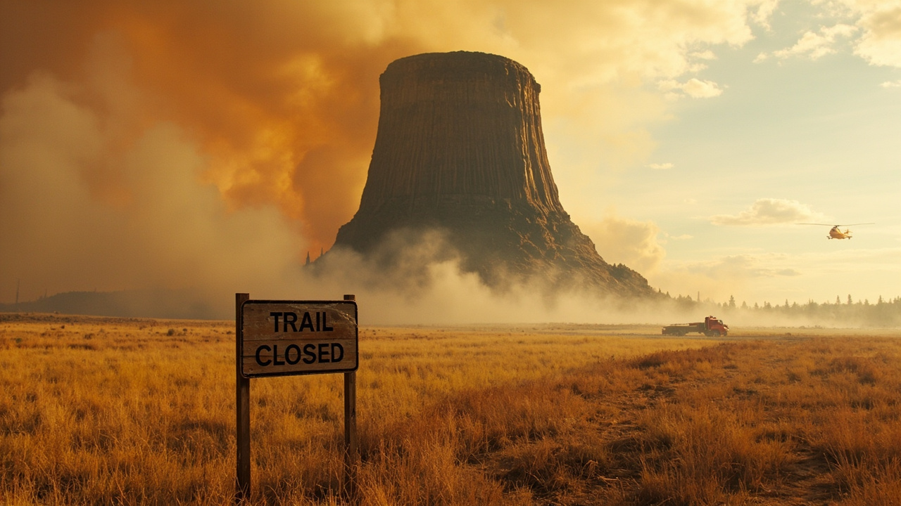
TL;DR: Two weekend wildfires burned about 600 acres around Devils Tower and closed all hiking trails, while the visitor center parking area stayed open for vehicles.
Trails closed, parking open
All hiking routes at Devils Tower National Monument were temporarily shut after fires ignited nearby over the weekend, according to the ShortGo report titled "Devil's Tower trails closed: wildfires burn 600 acres."
Park rangers confirmed Monday that motorists could still drive to the visitor center parking lot. Foot travel was different. Every hiking route remained shut while suppression personnel operated in the vicinity of the monument.
The distinction matters for wilderness readiness. A site can look accessible because the road is open, yet be closed to hikers, climbers approaching on foot, and anyone planning a loop walk. Visitors who arrived expecting a trail day had to change plans at the parking area.
Officials described the combined burned area as roughly 600 acres. That total came from two separate incidents burning near the monument. The closure was described as temporary and tied directly to active fire response, not to long-term repair.
Two fires, two start days
The first fire was identified as the Left Creek Fire. It was reported around midday Saturday to the southwest of Devils Tower, according to that same ShortGo report. By Sunday it had grown to about 282 acres.
The second fire was identified as the Newton Fire. It was found Sunday near the cemetery on the monument perimeter. It grew to roughly 300 acres.
Together, the two perimeters accounted for the approximate 600-acre total cited by officials. The timing shows how fast a weekend outing can change in the West in late summer. One start Saturday, another start Sunday, and by late Sunday two active footprints were burning near visitor infrastructure.
No confirmed containment figure had been released by late Sunday in federal and county updates. Engine crews and aircraft were still engaged Sunday evening. Cause also had not been reported at the time of the last public briefings cited in the report.
For backcountry travelers, an uncontained status means conditions can shift without much notice. Wind, dry grass, and new smoke can alter visibility and egress even if flames are not visible from a parking lot.
More than 100 firefighters and aircraft assigned
More than 100 firefighters with multiple aircraft or ground resources were assigned to the two incidents, Crook County Emergency Management said, as reported in the ShortGo account.
The crews gave priority to defending the monument and nearby infrastructure. That priority is common where a national monument concentrates buildings, roads, utilities, historic features, and day-use crowds in a small area. Protection work there requires close coordination among federal, state, and local organizations.
Suppression was complicated by the setting. Steep ground and visitor facilities demand careful movement of engines, crews, and aircraft while the public may still be driving nearby. Officials therefore asked people not to rely on social-media posts for tactical details.
The deployment figure — over 100 personnel plus air support — also explains why trails had to stay empty. Firefighters need roads and trail corridors clear for hose lays, lookouts, retreat paths, and aircraft water drops.
Evacuation alert moved from prepare to ready
On Sunday night the evacuation alert shifted from “prepare” to “ready,” according to the incident summary in the ShortGo report.
That change did not announce an evacuation order. It signaled heightened attention for communities near the fires. Residents and visitors were expected to stay alert for additional instructions and to be prepared to act if conditions changed.
For readiness planning, the lesson is to treat “ready” as a time to stage essentials, fuel vehicles, locate papers and medications, arrange transport for animals, and confirm communication plans. It is also the time to monitor official notices rather than wait for smoke to dictate decisions.
Restricted trail access can also affect traffic and lodging demand around the monument while crews remain active, because Devils Tower attracts tourists and outdoor recreationists through much of the year.
Why the landscape was ready to burn
Wyoming fire officials warned that danger remained high even as fall approached, according to KOTA Territory News in its September 4 report titled "High wildfire danger persists in Wyoming as fall approaches."
The Wyoming State Forestry Division pointed to drought, dry vegetation, and windy weather. Those factors, officials said, continue to create conditions where a small spark can become a wildfire.
That warning fits the Devils Tower weekend. Dry grass and wind do not require a large ignition source. A chain dragging on pavement, an unattended flame, equipment throwing sparks, or lightning can start a fast-moving perimeter under the right weather.
In Sheridan County, two wildfires were reported September 3 after passing vehicles dragged roadside chains, KOTA Territory News reported. The larger start, near Parkman along Highway 345, was held at 3.1 acres, according to Sheridan County Emergency Management. Multiple local and federal agencies joined nearby residents to contain it.
A Red Flag Warning was in effect Thursday, with critical fire weather expected to continue Friday, that KOTA Territory News report added. Officials urged drivers to ensure trailer chains were secured and not dragging. Residents were also urged to avoid actions that could throw sparks into dry vegetation and to review local fire restrictions before any outdoor burning.
A statewide pattern of many starts
Wyoming had not seen the same scale of large wildfires as some neighboring states, but crews faced repeated outbreak days, according to both state and regional reporting.
Crews responded to multiple days with 10 to 20 new fire starts, the Wyoming State Forestry Division said, as cited by KOTA Territory News and by the WyomingNews.com report titled "Wyoming responds to complex 2026 fire season."
The WyomingNews.com account, dated September 2, said Wyoming had seen nearly double the number of starts by that point in the summer compared with the same point in 2024, based on a Wyoming State Forestry Division release. The state described its method as an “all hands, all lands” approach to wildland fire management.
Wyoming State Forester Kelly Norris credited early coordination meetings among federal, state, and local fire leaders during winter and spring, saying that work built relationships focused on mutual support regardless of jurisdiction. That interagency cooperation, Norris said in the release, had become stronger and proved important during high activity.
Aircraft, modules, and hand crews in use
The scale of the state response shows why local closures should be taken seriously even when acreage looks modest compared with western megafires.
As of September 1, Wyoming Helitack had responded to 30 fires and its medium helicopter had supported 30 fires, together delivering more than 246,000 gallons of water since early June, according to the Wyoming State Forestry Division release summarized by WyomingNews.com.
Four contracted Single Engine Air Tankers had responded to 39 fires in 13 Wyoming counties, plus Montana and Nebraska, together delivering more than 236,000 gallons of retardant, including more than 180,000 gallons loaded from the Thunder Basin SEAT Base at Gillette Airport.
The Gannett Peak Module based in Lander had supported suppression on 11 fires in eight counties. The Pronghorn Module based in Douglas had responded to 22 fires in six counties. The Wyoming Smokebusters inmate hand crew had responded to 14 fires across eight counties.
Wyoming also reported 28 Emergency Fire Suppression Account fires estimated to cost $9 million as of September 1. By comparison, 24 such fires cost $37 million in 2024 under prior rules. This year’s account fires had burned approximately 40,000 acres, compared with 636,000 acres of state and private lands in 2024, the agency reported.
Norris linked the difference to rule changes adopted the prior year that emphasized aggressive initial attack, saying fires were being contained more quickly, incidents were shorter, and reliance on costlier out-of-state resources was lower while crews retained personnel and aviation support.
National resources were stretched. The United States was at National Preparedness Level 5, the highest national response level, with major fires in Washington, Oregon, Idaho, and Utah drawing crews from across the country, according to that same state release.
What visitors should do now
Do not enter a closed trail to get a better view. Closure boundaries protect both the public and firefighters moving through smoke, falling limbs, rolling rock, hose lines, and aircraft drop zones.
Check status before driving to the monument. For continuing information, the ShortGo report pointed readers to the National Interagency Fire Center, Crook County Emergency Management, and the National Park Service Devils Tower page for containment, closure, and evacuation updates.
Avoid spark-creating activity in dry grass. That includes dragging chains, parking hot exhaust over vegetation, using equipment that can throw sparks, and outdoor burning without first checking local restrictions, guidance echoed in the KOTA Territory News report.
Treat changing light, new smoke columns, ash fall, and increasing wind as cues to leave trailheads and grassy pullouts early. Conditions around an active perimeter can change faster than agency maps can be updated.
Planning a trip through fire country
Carry alternate plans. If Devils Tower trails are closed, do not improvise a cross-country route around barricades. Choose a different district, shorten the day, or delay the hike until officials reopen access.
Keep navigation independent of cell coverage. Download maps, note the visitor center location, and identify two driving exits from the area in case smoke reduces visibility on one road.
Stage for “ready” even if you are only visiting. Keep water, food, headlamps, sturdy shoes, and a full fuel tank. Know where people and pets will go if an area closes quickly.
Wyoming officials also expanded non-engine resources this year, including wildland fire modules, helitack crews, inmate hand crews, and Single Engine Air Tankers, KOTA Territory News reported. That expansion helps initial attack, but it does not remove risk for a hiker standing downwind of dry fuel.
The core readiness takeaway from September 6 is direct. Two modest starts near an iconic landmark produced about 600 acres burned, closed every trail, drew more than 100 firefighters with air support, and moved neighbors to a higher evacuation alert — all within about 48 hours.
Sources referenced
- Devil's Tower trails closed: wildfires burn 600 acres - ShortGo (https://shortgo.co/5069-devils-tower-trails-closed-after-weekend-sparks-crews-still-fighting-two-wildfires/)
- High wildfire danger persists in Wyoming as fall approaches - KOTA Territory News (https://www.kotatv.com/2026/09/04/wyoming-officials-urge-caution-wildfire-danger-remains-high/)