TL;DR: Yosemite's Dome Fire reached 3,795 acres with 15% containment on the morning of September 23, 2026, while Yosemite National Park stayed open and operating normally under a limited trail closure.
Tuesday Baseline Set The Stage
The Tuesday morning report listed the Dome Fire at 3,420 acres with 15% of its perimeter contained, according to the Sierra Sun Times account titled Yosemite National Park Dome Fire Tuesday Morning Update: 3,420 Acres with 15% Containment; Yosemite National Park is Open and Operating Normally.
That Tuesday report listed total personnel at 784 assigned to the incident.
Fire spread during that period moved north toward the footprint of the 2017 Empire Fire at a low to moderate rate.
Observers described that movement as creeping and smoldering behavior.
Handlines on the western part of the fire were holding at that time.
Crews reported continued progress in the Turner Ridge and Empire Meadows area.
Wildland firefighters continued to construct direct handlines where topography and fire behavior permitted.
Portions of the Bridalveil Creek trail system were being expanded as a primary control line.
Visitors were asked to drive with caution on Glacier Point Road because firefighting operations were active on that road.
Many aircraft continued to support suppression efforts.
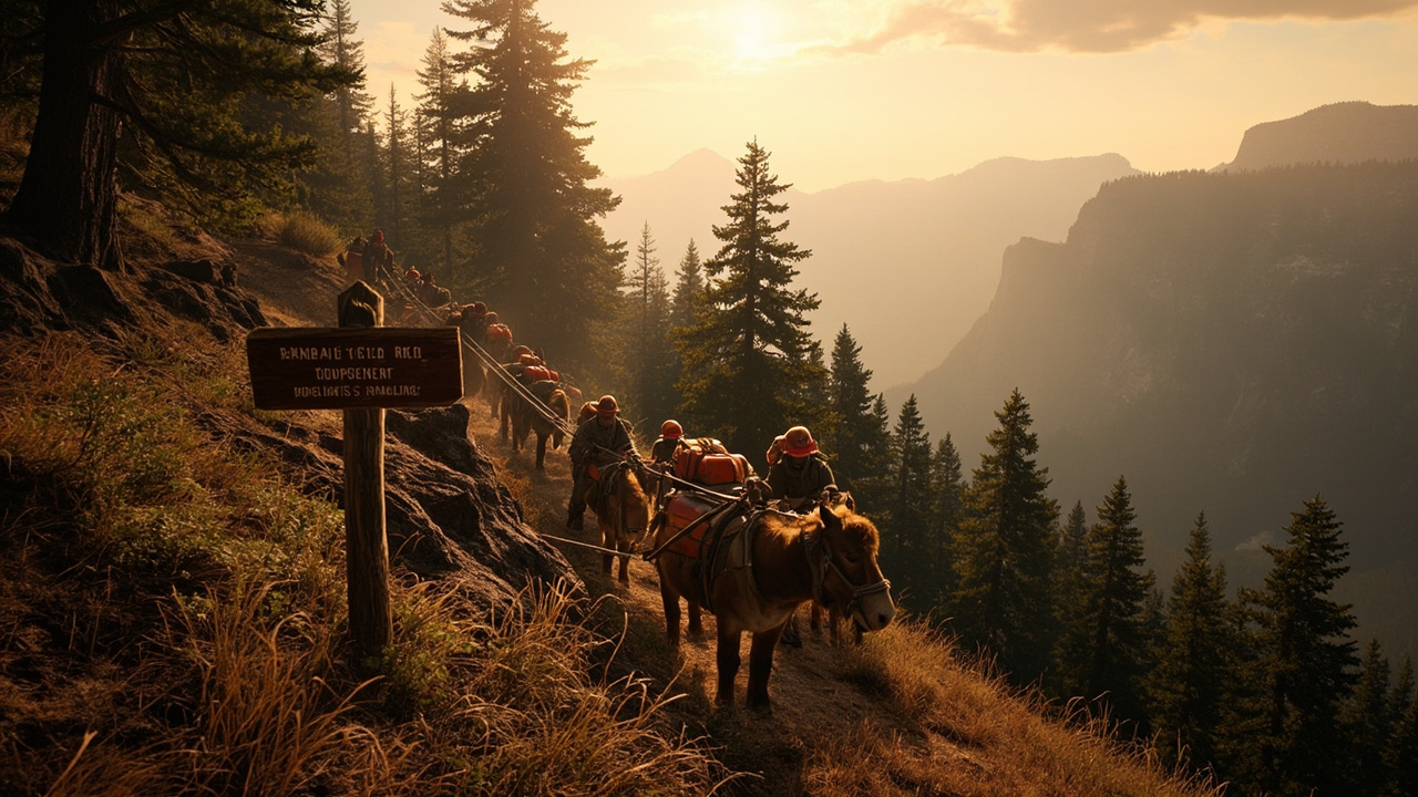
Pack mules supported crews by carrying supplies and backhaul.
Firefighters continued to assess structure protection at Yosemite West and Wawona.
That work supported local communities while crews continued preparation work and contingencies.
Wednesday Morning Growth And Staffing
The U.S. National Park Service report titled Dome Fire Update, September 23, 2026 (morning) listed the fire at 3,795 acres with 15% containment.
That update listed 840 personnel assigned.
The fire had grown 273 acres since the previous day's update.
Personnel assignments had increased by 56 people over the same period.
Overnight fire activity concentrated along the north and northeast sides between Horse Ridge and Empire Meadows.
That active ground lay in the old 2017 Empire Fire footprint.
On the east side near Horse Ridge, activity was light.
Isolated pockets of fuel continued burning in that eastern sector.
Firefighters expected behavior similar to a few days earlier, when winds also came from the southwest.
Firefighters expected mostly surface fire.
That type of surface fire lets crews work directly on the fire's edge.
Direct work becomes more difficult where wind and slope line up.
Containment Lines And Fire Camps
Firefighters widened containment lines between Empire Meadows and Turner Ridge.
Crews worked that segment from the top down and the bottom up.
Crews performed the same widening work along the Bridalveil trail system toward the 2017 Empire Fire footprint.
Helicopters continued to support firefighters on the ground.
Pack strings carried supplies to firefighters on the fire line, according to the National Park Service.
A second fire camp was set up at Badger Pass.
The Badger Pass camp supported firefighters and reduced travel time to the fire.
The Incident Command Post remained at the Mariposa County Fairgrounds.
Fuels Driving Behavior
The Sierra Sun Times Tuesday report described standing closed-canopy timber producing active behavior and spotting.
Adjacent fuels became less continuous with scattered timber, brush, grass, and exposed granite hillsides.
The red fir fuel type included montane shrub and brush understory.
Pockets of nonburnable fuel occurred in granite rock outcrops.
Fir trees were large diameter and over 100 feet tall.
Those trees suffered from insect and disease mortality.
That mortality created a significant snag component and large amounts of heavy dead and down coarse woody debris.
The Tuesday report stated that dense, closed-canopy red fir stands produced the most active behavior.
Tor ching and isolated crown fire pockets in those stands contributed to spotting.
Fuels in 2017 fire footprints had less closed canopy.
Those footprint areas contained significant dead and down material with standing snags.
That combination increased spotting potential.
Montane shrubs and brush in the understory were generally available to burn.
Those shrubs were not at critical fuel moisture levels.
Heavy dead and down fuels were dry.
Moisture in 1,000-hour fuel was below 10%.
Active burning illustrated a fuel complex generally available across all types and size classes.
Weather Shift Toward Drier Conditions
The Tuesday report said weather systems that brought clouds were moving out of the area.
Higher temperatures were expected with drying conditions.
Transport winds trending northeast could shift smoke patterns.
The Wednesday morning National Park Service update said conditions would be much drier.
Little to no cloud cover was expected over the fire.
Temperatures were expected to be a bit warmer, in the upper 60s.
Relative humidity was expected around 30%.
Winds had come from the northwest the previous day.
Winds were expected to shift to the southwest, described as the normal pattern.
Smoke And Air Quality Pattern
The Tuesday report listed UNHEALTHY air in Wawona and Yosemite Valley during the morning, with smoke clearing in the afternoon.
Tuolumne Meadows and Hodgdon Meadow were expected to experience mostly GOOD air quality.
El Portal and Mariposa were expected to see periods of MODERATE air quality.
Smoke settled overnight in Wawona and Yosemite Valley.
Current air quality monitoring was available at https://fire.airnow.gov/#7/38.532/-119.416.
The Wednesday Sierra Sun Times update described periods of UNHEALTHY air that morning in Wawona and Yosemite Valley, with smoke clearing in the afternoon.
That update expected mostly MODERATE air quality at Mariposa and Hodgdon Meadow.
El Portal was expected to see periods of UNHEALTHY FOR SENSITIVE GROUPS.
Tuolumne Meadows was expected to have GOOD air quality in the morning with periods of UNHEALTHY FOR SENSITIVE GROUPS in the afternoon and evening.
Park Open With Defined Trail Closures
The National Park Service stated Yosemite National Park was open and operating normally with defined exceptions.
The Chilnualna Falls trail was closed because of the Dome Fire.
Trails from the top of Chilnualna Falls toward Buena Vista and Crescent Lakes were also closed.
Buena Vista and Crescent Lakes remained reachable from the east.
Ostrander Trail and all areas and trails south of it were closed.
The closed area extended east of the Wawona Road from Wawona to Chinquapin.
The closure footprint could be seen on the public information map.
The Sierra Sun Times Tuesday report linked that public information map at https://arcg.is/z5HLC4.
The report also linked the full Closure Order and Closure Order Map for the Dome Fire Safety Closure.
Evacuations And Infrastructure Status
The National Park Service reported no evacuation orders or warnings in place.
The agency reported no immediate threats to infrastructure or developed areas.
Structure protection assessment continued around Yosemite West and Wawona during the Tuesday operational period.
Aviation Safety And Drone Restriction
The Tuesday report reminded readers that wildfires and drones do not mix.
Unauthorized drones can force firefighting aircraft to stop flying.
Such interruptions delay suppression efforts and allow fires to grow.
The public message stated, If you fly, we can't.
Visitors were asked to keep drones away from wildfires to protect firefighters, communities, and landscapes.
Aviation resources own the airspace around wildfires.
A Temporary Flight Restriction for the Dome Fire was posted at https://tfr.faa.gov/tfr3/?page=list.
What Backcountry Travelers Should Do
Check the public information map before choosing a route near Wawona, Chinquapin, Ostrander, Buena Vista, or Crescent Lakes.
Use an eastern approach if Buena Vista or Crescent Lakes are the destination.
Avoid the closed Chilnualna Falls corridor and all areas south of Ostrander Trail.
Slow down on Glacier Point Road where crews and equipment operate.
Expect aircraft activity overhead and give suppression operations space.
Carry the ability to adjust plans when smoke settles overnight in valleys and drainages.
Use the AirNow fire monitor to check smoke before exertion in Wawona, Yosemite Valley, El Portal, Mariposa, Tuolumne Meadows, or Hodgdon Meadow.
Sources referenced
- Dome Fire Update, September 23, 2026 (morning) - Yosemite National Park (U.S. National Park Service) (https://www.nps.gov/yose/learn/news/dome-fire-update-september-23-2026-morning.htm)