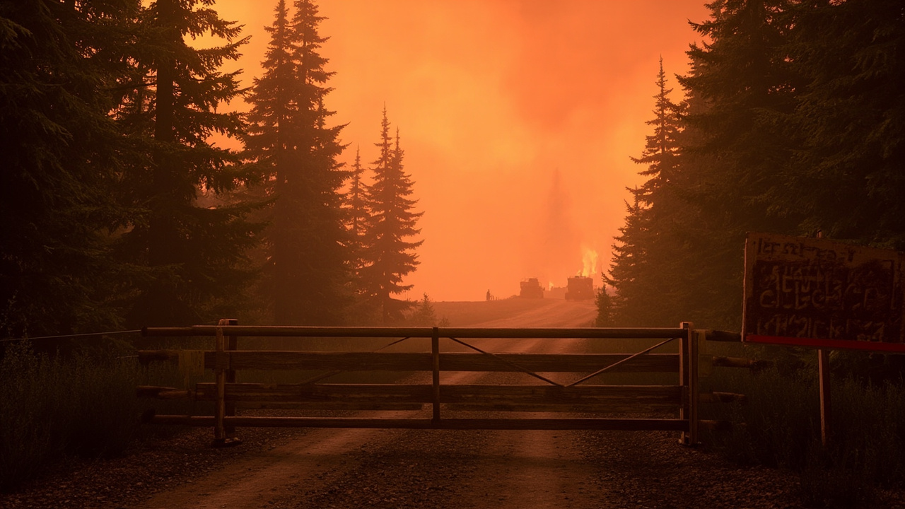
TL;DR: The Mt. Hood National Forest expanded its emergency closure on August 27, 2026, prohibiting all public entry around the Austin Fire and the Narrows Fire on the Clackamas River Ranger District.
That expansion is the newest verified action for backcountry travelers to understand. According to the U.S. Forest Service release titled “Mt. Hood National Forest | Austin Fire emergency closure expanded on Mt. Hood National Forest | Forest Service,” the order covers roads, trails, campgrounds and off-road travel within a defined perimeter. Signs are posted at trailheads, roads and other access points. The Forest Service states the closure is necessary for public safety and to allow firefighters and heavy equipment to operate efficiently and safely.
The closure applies to two fires in the same ranger district. The Forest Service identifies them as the Austin Fire and The Narrows Fire, located on the Clackamas River Ranger District. Coverage titled “Mt. Hood National Forest expands closures as wildfires burn” from OPB places both fires in that district and reports expanded shutdown of public entry and travel. Coverage titled “Wildfire updates: Hwy 224 closed due to Austin, Narrows fires; Grasshopper Fire now 76% contained” from KPTV also places both fires on the Clackamas River Ranger District and describes an expanded emergency closure order issued Thursday.
What changed on August 27
The Forest Service issued its expansion notice with a release date of August 27, 2026. The agency describes the action as an expanded existing emergency closure order for the Austin Fire and The Narrows Fire.
According to the Forest Service, the expanded closure prohibits all public entry within the defined area. That prohibition includes travel on Forest Service roads, use of Forest Service trails or campgrounds, and any off-road travel. The order is mapped and written in full in a closure order and map posted by the Forest Service.
The Forest Service provides the closure order and map online through its Clackamas River RD Fires alert page. It also directs the public to follow InciWeb for updates on the Austin Fire through the incident page for OR-MHF-Austin Fire. The Forest Service lists its Supervisor’s Office at 16400 Champion Way in Sandy, Oregon, with phone number (503) 668-1700 for the Mt. Hood National Forest.
Roads now inside the closure
Closed Forest Service roads include, but are not limited to, portions of Forest Road 46, Forest Road 57, Forest Road 63 and Forest Road 70. The Forest Service lists those four road numbers as examples within a larger closed road system.
Oregon Highway 224 east of Fish Creek is also closed under the expansion. The Forest Service names OR Highway 224 east of Fish Creek in its road-closure description. KPTV reported that Highway 224 was closed east of Fish Creek due to the Austin and Narrows fires, with a morning update Thursday placing the highway closure in effect Thursday morning and an afternoon briefing again listing Highway 224 east of Fish Creek as closed Thursday afternoon.
Reporting titled “Austin Fire in Mount Hood National Forest remains uncontained, officials say” from KATU states that on Thursday morning the Mt. Hood National Forest expanded closures for fires burning in Clackamas County. That account lists Highway 224 east of Fish Creek among the closures. KPTV also lists Forest Road 46, FR 57, FR 63 and FR 70 alongside Highway 224 in its description of the expanded existing emergency closure order Thursday.
Recreation sites now closed
Popular closed recreation sites named by the Forest Service include Lake Harriet, Timothy Lake, Bagby Hot Springs, and campgrounds along the Clackamas River east of Carter Bridge. Those locations are identified as examples of closed sites within the defined area.
OPB reports that officials shut down public entry and travel across several roads and popular recreation sites, including Lake Harriet, Timothy Lake and Bagby Hot Springs. OPB also reports closure of campgrounds along the Clackamas River east of Carter Bridge. KATU lists Lake Harriet, Timothy Lake, Bagby Hot Springs and campgrounds along the Clackamas River east of Carter Bridge as closed.
KPTV reports that PGE has closed Timothy Lake for public safety since egress is currently limited. That detail explains one access constraint at Timothy Lake beyond the federal closure. KPTV lists Lake Harriet, Bagby Hot Springs and campgrounds along the Clackamas River east of Carter Bridge among popular closed recreation sites, and separately notes the PGE action at Timothy Lake.
How large the fires were on August 27
The Austin Fire had burned more than 9,000 acres as of Thursday, according to OPB and KPTV. KATU and KPTV give a more precise Thursday figure of 9,237 acres for the Austin Fire. OPB describes the Austin Fire as more than 9,000 acres and still zero-percent contained as of Thursday afternoon.
KATU reports that fire officials said the Austin Fire had burned 9,237 acres and remains uncontained. KPTV reports that as of Thursday morning the Austin Fire had burned about 9,237 acres and was 0% contained. KPTV also states that as of Thursday the Austin Fire had burned more than 9,000 acres since it started in early August and was 0% contained.
The Narrows Fire was much smaller but also uncontained. KPTV quotes fire official Lisa Wilkolak saying the Narrows Fire had burned roughly 280 acres on the Clackamas River Ranger District. A KPTV morning update Thursday placed the Narrows Fire at about 284 acres and 0% contained. OPB does not give a separate acreage for the Narrows Fire but identifies it as burning alongside the Austin Fire in the Clackamas River Ranger District.
OPB reports that the Austin Fire remains under investigation. That status is stated as of its August 27 report timed at 11:36 p.m.
Fire behavior, terrain and containment work
KATU quotes fire officials saying firefighters strengthened indirect primary containment lines on the southwest side using heavy equipment along existing roadways. The same update says both direct and indirect containment strategies are in place throughout the fire area. KATU quotes the stated objective as keeping the Austin Fire within the smallest possible footprint.
KPTV reports that the western side of the Austin Fire was the most active. It quotes Wilkolak saying the top priority was determining where crews could build containment lines because the terrain is steep and crews cannot work directly on the fire in many places. That account presents steep terrain as the reason direct attack was not possible in many locations.
KPTV reports that the western side of the Austin Fire recently moved into the scar of the 2020 Riverside Fire, which should help stop some growth. It also quotes Wilkolak saying the Narrows Fire had not grown much because it is burning entirely within the scar. That scar history is presented as a factor influencing expected fire progression.
KPTV also quotes Wilkolak saying there were several days of hot and dry weather, and that when those days accumulated the fire became active. That description addresses the weather pattern preceding Thursday’s activity.
Evacuations linked to the same corridor
OPB reports that the shutdown also prompted authorities to issue Level 3 “Go Now!” evacuation orders for the same areas. The Clackamas County Sheriff’s Office is identified by OPB as the source saying the closure will keep people safe and away from crews working to contain the fires.
KPTV reports that the Clackamas County Sheriff’s Office issued a Level 3 – Go Now! notice for the same area as the Highway 224 closure east of Fish Creek. Its 11:30 a.m. update places that evacuation notice and highway closure together Thursday. The agency maintains evacuation information through its Clackamas County Sheriff’s Office social channels, which KPTV lists among county-level evacuation sources for Oregon.
KPTV reports that Wilkolak said the closure is necessary to keep the community and the hundreds of firefighters battling the Austin Fire safe. Wilkolak works on the Narrows Fire as well, according to KPTV. The same report notes that hundreds of firefighters were assigned to the Austin Fire effort.
Why officials restricted access before Labor Day
KPTV quotes Wilkolak saying officials do not want to prevent recreation and forest access that many people would want around Labor Day. The quote continues that the forest expanded the closure after careful consideration, but that expansion was required for the safety of firefighters and the public. KPTV carries that full statement twice in its Thursday updates.
The Forest Service frames the restriction the same way. It says the closure is necessary for public safety and to allow firefighters and heavy equipment to operate efficiently and safely. OPB similarly reports that the Clackamas County Sheriff’s Office says the closure will keep people safe and away from containment crews.
Gov. Tina Kotek surveyed firefighting efforts Thursday before giving an update, according to KPTV. KPTV states that Kotek traveled with the Oregon Military Department and the Oregon State Fire Marshal to survey the state’s wildfire response Thursday. That survey occurred while multiple wildfires were burning across Oregon and Washington and forcing evacuations and highway closures.
Fire restrictions, illegal campfires and drought
Fire restrictions have been in place on Mt. Hood National Forest since July 1, according to the Forest Service. The agency posts current fire restrictions on the Mt. Hood National Forest website through its fire-restrictions alert page.
The Forest Service states that illegal campfires continue to be reported across the Forest despite those restrictions. It says those campfires cause fire personnel to be diverted from active, more dangerous wildfires. OPB also reports that the Forest Service warned people to continue following fire restrictions to avoid sparking new wildfires.
The Forest Service states that drought, combined with hot and dry days, has created conditions extremely receptive to sparks or small fires spreading into larger, uncontrolled fires. OPB similarly reports that drought conditions combined with hot and dry weather increased wildfire risk. KPTV cites hot and dry weather as a factor in heightened activity.
The Forest Service states that every forest visitor has a responsibility to help protect public lands from human-caused wildfires. That responsibility message accompanies its notice that current fire restrictions remain posted online.
What wilderness travelers should verify next
The Forest Service says closure signs are posted at trailheads, roads and other access points. It says the complete closure order and map are available through its alerts system. Travelers can use that order and map to identify the defined area rather than relying on the abbreviated road and site lists.
The Forest Service directs the public to InciWeb for Austin Fire information. OPB published an aerial view of the Austin Fire dated August 23, 2026, credited to InciWeb. KPTV lists county sheriff channels for evacuation levels, including the Clackamas County Sheriff’s Office channel for Clackamas County.
For route planning, the named control points are Fish Creek on Highway 224 and Carter Bridge along the Clackamas River corridor. The Forest Service places the Highway 224 closure east of Fish Creek and the affected river campgrounds east of Carter Bridge. Those two markers define the eastern highway and river-campground limits stated in the federal notice.
Sources referenced
- Mt. Hood National Forest expands closures as wildfires burn - OPB (https://www.opb.org/article/2026/08/27/mt-hood-forest-wildfires-closures/)