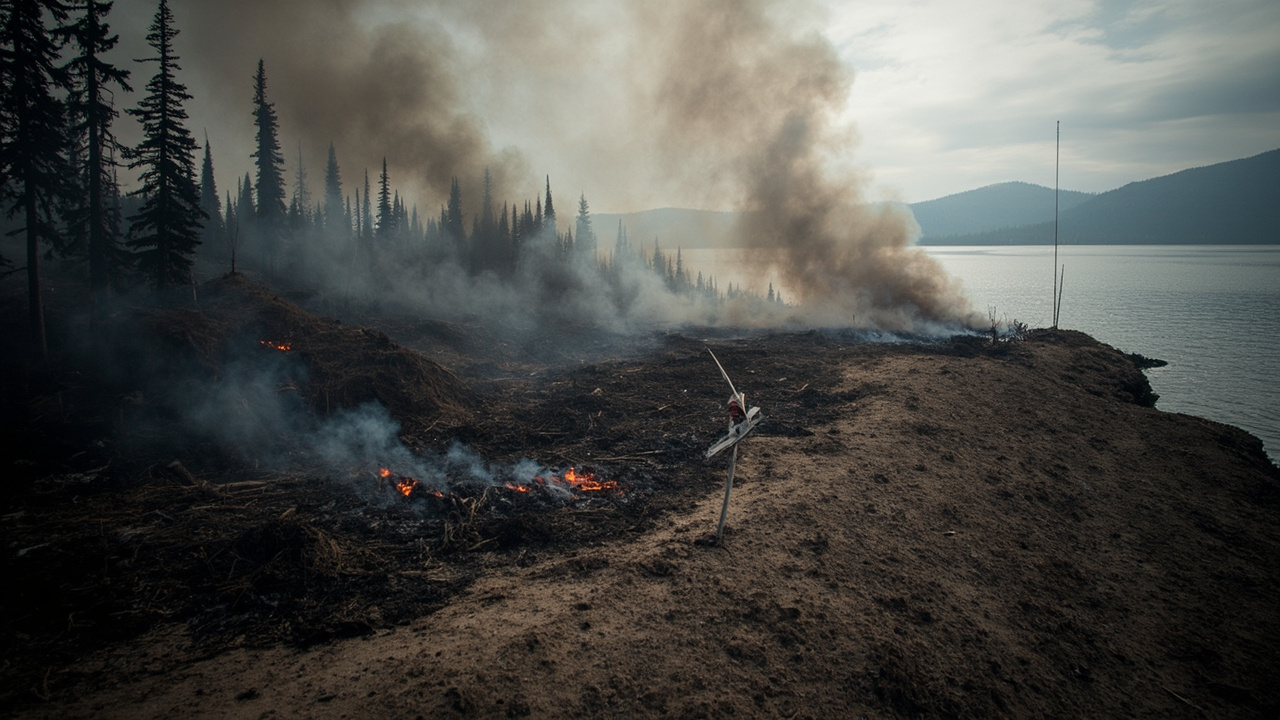
TL;DR: All Go, Set and Ready Orders Are Off, But The Woods Are Still Closed
All Level 1, Level 2 and Level 3 evacuation orders for the Three Queens, King and Goat fires were lifted in Kittitas County, Washington, in an update issued October 9, 2026 at 4:15 p.m.
The Three Queens Fire, which began about 1 mile northwest of Kachess Lake, measured 9,582 acres with 45% containment at the time of that update, according to Apple Valley News Now. No Level 3 Go Now, Level 2 Get Set or Level 1 Be Ready evacuations remained listed for the fire. As of October 11, 2026, the same fire measured 9,582.3 acres and remained 45% contained, while the King Fire measured 3,440 acres and reached 36% containment, according to IQAir. County officials warned that U.S. Forest Service closure orders still covered many nearby areas and visitors should review closures on the Forest Service website before entering.
What Was Lifted On October 9
Three Fires, Three Levels, Zero Active Zones
The October 9 update applied together to the Three Queens, King and Goat fires in Kittitas County. All Level 1, Level 2 and Level 3 evacuation orders were lifted, according to Apple Valley News Now.
The status box for the Three Queens Fire listed Level 3, Level 2 and Level 1 evacuations each as none. A map of evacuation zones was described as available online, with other land, road and trail closures available through a separate link.
For wilderness readiness, the distinction matters. Level 3 means Go Now and requires immediate departure. Level 2 means Get Set and requires readiness to leave quickly. Level 1 means Be Ready and requires preparation for possible evacuation. The October 9 action removed all three categories at once rather than stepping them down one level.
Where The Lift Applies
The fires center on country around Kachess Lake, Cle Elum Lake, Cooper Lake and Box Canyon Creek in Kittitas County, according to IQAir.
Areas identified as affected by the Three Queens and King fires include Baker Lane, Box Canyon Creek, the Cle Elum Lake area, the Cooper Lake area, Kachess Campground, the Kachess Lake area and Kittitas County more broadly, according to IQAir.
That geography explains why the evacuation change affects dispersed campers, hunters, homeowners along lake roads, and travelers using forest trails, not only one town.
Current Fire Size And Containment
Three Queens Fire At 9,582 Acres And 45% Contained
The Three Queens Fire origin is described as about 1 mile northwest of Kachess Lake in Kittitas County, Washington, according to Apple Valley News Now.
At the October 9 update, the fire was listed at 9,582 acres and 45% contained. As of October 11, the fire was listed at 9,582.3 acres and 45% contained, with crews reinforcing containment lines and protecting structures near Kachess Campground and Baker Lane, according to IQAir.
The Kittitas County Sheriff's Office said the fire was staffed with smokejumpers and local firefighting resources, according to Apple Valley News Now.
King Fire At 3,440 Acres And 36% Contained
As of October 11, the King Fire had burned 3,440 acres and was 36% contained, according to IQAir.
Crews were monitoring for potential southward spread and maintaining existing control lines to protect nearby communities, according to IQAir.
Recent rain and high humidity had reduced fire activity, but heavy dead vegetation continued to burn and smolder, according to IQAir.
Why The Fire Is Still Dangerous After The Lift
Creeping Ground Fire And Persistent Smoke
The Kittitas County Sheriff's Office said creeping and smoldering fire had been spotted in areas where firefighters cannot reach, with smoke persisting despite cooler temperatures, according to Apple Valley News Now.
Although some rain had fallen, firefighters said conditions were unseasonably dry and the rain had not significantly impacted the fire, according to Apple Valley News Now.
For backcountry users, that combination means a contained perimeter does not mean a cold interior. Unstaffed pockets can hold heat, produce smoke, and threaten lines if winds shift.
Dry Fuels Despite Rain
Recent rain and high humidity reduced activity on the King Fire, yet heavy dead vegetation continued to burn and smolder, according to IQAir.
On the Three Queens Fire, the same pattern was reported: cooler weather and some rainfall did not end smoldering in inaccessible ground, according to Apple Valley News Now.
Travelers should therefore treat recent precipitation as a moderating factor, not a full control factor, until agencies declare further containment or control.
Closures Remain Even Though Evacuations Ended
Forest Service Orders Still Cover The Fire Area
Kittitas County officials said that although evacuations had been lifted, many nearby areas were still under closure orders from the U.S. Forest Service, according to Apple Valley News Now.
Visitors were urged to check closures on the Forest Service website before entering the area, according to Apple Valley News Now.
Sheriff's officials said the Forest Service fire area would likely remain closed to the public until fire season was finally over in order to protect public safety, according to Apple Valley News Now.
That warning is the central readiness point: return home is permitted where evacuations lifted, but entry into the closed forest is not.
Earlier Access Changes Show How Closures Shift
On September 21, officials said closure orders in the Okanogan-Wenatchee National Forest had been reduced as containment progressed, according to Apple Valley News Now.
U.S. Forest Service officials said more access was available for the High Buck Hunt, the Pacific Crest Trail, and other areas in the Cle Elum Ranger District, according to Apple Valley News Now.
The lesson for hunters, thru-hikers and dispersed campers is to verify the current district order, not rely on September access news or the October evacuation lift alone.
How The Incident Developed
From August Spread To October Hold
The incident log shows steady growth through late August. The fire was listed at 6,706 acres and 13% contained on August 23, 7,285 acres and 13% contained on August 25, 7,301 acres and 13% contained later that day, 7,758 acres and 13% contained on August 26, and 8,240 acres with 5% containment later that morning, according to Apple Valley News Now.
By August 31, the fire was listed at 8,989 acres and 5% contained in the morning and 8,993 acres and 5% contained in the evening, according to Apple Valley News Now.
The U.S. Forest Service held a public meeting for the Three Queens, King and Goat fires on August 31 at 7:00 p.m. at the Cle Elum-Rosalyn High School Gymnasium at 2692 WA-903 in Cle Elum, according to Apple Valley News Now.
September Evacuation Adjustments And Command Change
On August 23, Upper Salmon La Sac had been upgraded to Level 3 evacuation because of the adjacent Goat Fire, then described as 12 acres and 0% contained, according to Apple Valley News Now.
On September 3, part of Upper Kachess Dam Road was downgraded from Level 3 to Level 2, while Baker Lane was reduced from Level 2 to Level 1, according to Apple Valley News Now. The Three Queens Fire was then listed at 9,364 acres and 0% contained.
Containment then climbed: 9,349 acres and 8% on September 1 in the evening, 9,012 acres and 5% earlier that day, 9,444 acres and 11% on September 5, 9,501 acres and 13% on September 8, 9,518 acres and 13% on September 9, 9,528 acres and 14% on September 10, 9,527 acres and 20% on September 12, 9,531 acres and 20% on September 15, 9,558 acres and 23% on September 16, 9,562 acres and 23% on September 17, and 9,575 acres and 31% on September 23, with figures attributed to the National Interagency Fire Center, according to Apple Valley News Now.
On the evening of September 21, the Okanogan-Wenatchee National Forest Type 3 team was scheduled to assume command of the Three Queens, King and Goat fires, according to Apple Valley News Now. Officials said substantial progress was being made on all three fires, with suppression repair work underway at the Three Queens Fire.
What Returning Residents And Visitors Should Do
Confirm Zone, Route And Closure Before Moving
Check the online evacuation-zone map and the separate link for land, road and trail closures referenced in the October 9 report before driving toward Kachess Lake or the Cle Elum Ranger District, according to Apple Valley News Now.
Check Forest Service closures separately, because county evacuation status and federal closure status are different systems and can change on different schedules.
Do not plan a hunt, Pacific Crest Trail section, or campground stay around older September access notes without rechecking the current order.
Protect Structures And Lungs During Smoldering
Crews were reinforcing containment lines and protecting structures near Kachess Campground and Baker Lane as of October 11, according to IQAir.
Smoke persisted around the Three Queens Fire despite cooler temperatures, according to Apple Valley News Now.
Masks were listed as available at Kittitas County Public Health at 507 N Nanum Street, Suite 102, in Ellensburg, and at Upper Kittitas County District Court at 700 E 1st Street in Cle Elum, according to IQAir.
Anyone returning to a home near Baker Lane, Kachess Campground, Box Canyon Creek, Cooper Lake or Cle Elum Lake should inspect for smoke intrusion, ash, and heat in dead fuels nearby, and keep a clean-air room and evacuation bag ready even after orders lift.
Sources referenced
- All evacuation orders lifted for Three Queens Fire and other nearby wildfires | News | applevalleynewsnow.com (https://www.applevalleynewsnow.com/news/all-evacuation-orders-lifted-for-three-queens-fire-and-other-nearby-wildfires/article_2bcbdbe0-4b62-47e6-a7a6-881682a634c8.html)
- Wildfire Map Spotlight: Three Queens and King Fires, Washington | IQAir USA (https://www.iqair.com/newsroom/wildfire-map-spotlight-three-queens-and-king-fires-washington)