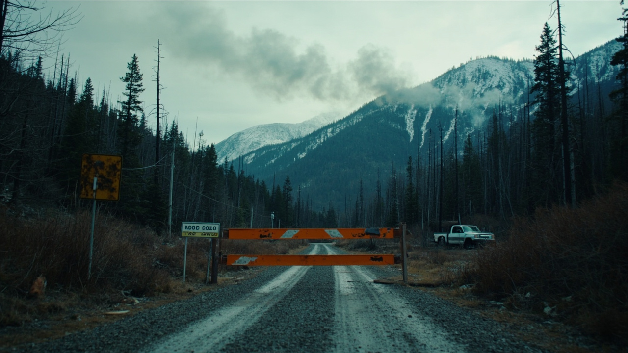
TL;DR: The Wild River Fire in New Hampshire's White Mountain National Forest stood at 821 acres and 53% containment on Nov. 10, 2026, and the closures covering Wild River Road, the Shelburne Trail and parts of the High Water Trail remained in force with no reopening date announced.
Late-autumn hikers heading for Gorham, Shelburne or the Wild River valley cannot use the closed road or trails. The U.S. Forest Service listed the burn at 821 acres and 53% containment on Tuesday morning, WMTW reported, and the closure order issued the previous Wednesday was still in effect that day. The fire sits about seven miles southeast of Gorham, roughly a mile west of the Maine line in Coos County, InDepthNH.org reported; WMTW placed it just south of Gilead, Maine, near Evans Notch. New Hampshire Public Radio reported that the Forest Service calls it the largest blaze in that forest since 1918.
Where the fire stands
Containment climbed quickly once the weather turned. The Portland Press Herald traced the arc from roughly 20% on Friday, Nov. 6, to 29% on Sunday, Nov. 8, and about 53% on Tuesday, Nov. 10. NHPR reported that the fire was not expected to spread, and WMTW reported that the blaze was spotted on the afternoon of Nov. 1.
The response shrank as fire behavior moderated. Assigned personnel peaked at 140 on Friday and stood at 88 on Tuesday, the Press Herald reported, citing the Forest Service's statement that managers were adjusting resources as the potential to spread fell. The acreage estimate settled too: InDepthNH.org recorded 982 acres on Nov. 4, a Forest Service release dated Nov. 5 put the burn at 856 acres after remapping, and the figure reached about 821 acres over the weekend.
In the first full week, contained ground was largely confined to the Wild River's banks and part of the northeast flank about a half-mile from the state line, the Press Herald reported. By Tuesday, crews had also picked up a brook on the west side and stretches of the fire's jagged northern edge.
The cause remains unresolved. The Forest Service said the fire was human-caused and under investigation, NHPR reported; WMTW reported that officials disclosed that finding on Thursday, Nov. 5. Michael Matson, New Hampshire's chief of forest protection, said no homes sit within 1.5 miles of the burned ground, according to NHPR.
What is closed, and what is not
The Nov. 4 order blocks public entry to the fire area. According to InDepthNH.org, it shuts the whole Shelburne Trail, portions of the High Water Trail and other routes, and every mile of Wild River Road. The order also keeps the corridor clear for firefighters and emergency crews.
The Appalachian Trail is a separate case. The Appalachian Trail Conservancy reported on Nov. 9 that the A.T. remained open where it crosses the Carter-Moriah Range near Gorham, several miles west of the burn, while the Kenduskeag Trail, which leaves the A.T., stayed closed. The conservancy warned that hikers would likely still see and smell smoke. On Nov. 3, it had placed the fire several miles east of the A.T., near northbound mile 1,895, when the burn was about 300 acres.
Why a contained fire keeps smoking
Crews on Tuesday were mainly mopping up hot spots they could reach and clearing brush to tie a continuous line around the perimeter, NHPR reported. A Forest Service release dated Nov. 5 described mop-up as cooling residual heat beside control lines — smoldering plants, logs and roots that can flare back up — and said the work secures the perimeter and lowers the odds of flare-ups.
Matson told the Executive Council on Tuesday that the burn would keep creeping through the duff "probably until winter conditions come," NHPR reported. Long-running drought and a buildup of tinder on the forest floor were feeding it, the station reported. On Nov. 5, the Forest Service said no storm big enough to end the fire season was then in the forecast.
Rain, leaf blowers and aviation
Showery weather had sapped some of the fire's strength, and winds below 10 mph held back its spread, per NHPR. Officials at a public meeting in Shelburne on Tuesday said leaf blowers had earned their place on the line by stripping leaves and brush ahead of containment work, NHPR reported.
In its Nov. 5 release, the Forest Service said multiple aviation assets would be used near the head of the fire and against any known or potential spot fires, and that crews could work the edge directly when humidity rose.
Ground that punishes crews
Steep, rocky country remained a hazard for firefighters working far from roads, and the Forest Service said wet conditions and the Wild River's flashy nature required constant reassessment before crews committed, according to its Nov. 5 release.
Ben Wagner, an operations section chief, said the fire had run through felled hardwood but slowed or stopped in conifer stands, and that brooks and creeks acted as natural control lines, the Portland Press Herald reported. No firefighters had been hurt, officials said. Wagner described the ground by asking listeners to picture climbing 2,500 vertical feet with chainsaws and leaf blowers, then carrying an injured colleague down and across a river before dark.
What it means for a late-season trip
The closure boundary appears in the order and on a map hosted by the forest, InDepthNH.org reported. Hikers should follow posted signs and directions from fire crews, the conservancy advised, and should expect smoke.
Officials also asked the public to keep drones away, because they endanger helicopters and the Forest Service's own drones used for surveillance, NHPR reported. On Nov. 3, with the region in moderate drought, the conservancy urged hikers to consider going without campfires until conditions improved.
Road repairs and what comes next
Some of Wild River Road's damage predates the fire. Forest Service officials said Tuesday that funding had been secured through the Federal Transportation Administration to begin repairs, including work on three bridges harmed by 2023 flooding, NHPR reported.
A public information meeting ran from 6 to 7 p.m. on Tuesday, Nov. 10, at Shelburne Town Hall, 74 Village Road, with a Microsoft Teams option, WMTW reported. The conservancy noted that cold, wet conditions were expected to dampen fire activity further that day. The Forest Service had not announced a reopening date for the road or the closed trails.